No time to cry

My Munga 2021 story


Standing on the start line of the Munga on 1 December, at noon on a typically warm summer’s day, was daunting to say the least. Having had the whole morning to finish packing and preparing my bike and kit had done little to subdue a creeping nervousness about tackling The Toughest Race on Earth.

Owing to some road closures, race director Alex Harris had added a detour that increased the distance of this single-stage MTB race from Bloemfontein to Wellington in the Western Cape to 1,154kms. This is substantially further than the advertised length of 1,000kms, and c.80kms further than last year’s version. It had crossed my mind, more than once, that this 154kms was at least an extra 8 hours of riding, while the 5-day cut-off time remained the same.

It is difficult in the face of a significant challenge like this to know if one has done enough training. While I had racked up many kms during the build-up to this race, including many hours of weight training with all my kit attached to my bike, there was a certain amount of doubt in my mind as to whether I had done enough. What is enough anyway?

One would be unlikely to attempt to do the full distance in training. So, while I had completed the Munga Grit in the Cradle in October 2021, that was only 515kms long. I say only rather flippantly as before completing the inaugural 2020 version of the Cradle Munga Grit, my furthest single-stage ride was 270kms. These are not short distances by most people’s definitions. Completing the 2021 Munga Grit came with its own challenges but was, nonetheless, a successful training event for full Munga. But it was only half the distance of the Munga! Welcome to the mind-bending distance recalibration that every ultra-endurance athlete has almost certainly come to terms with.

After the starter’s gun went off, it was time to put these doubts aside and get on with the task at hand. The race has 10 official water points (WPs) located roughly every 100kms and 5 race villages (RVs) located at roughly 200km intervals. My ride strategy was to break the ride down into the 5 segments between race villages, and then sub-segments between water points, reducing the ride into shorter mentally manageable chunks. I also wanted to try and ride throughout each night, while limiting the amount of time riding in the heat of the day.

My riding partner, Raymond Blake, and I (both sponsored by Carbon Bike Repair) quickly settled into a steady rhythm, largely ignoring the fast pace set by many of the other 170 riders we started off with, focussing instead on not over-exerting ourselves too early on. Doing this often means drifting backwards through the field and forgoing some groups that form in the beginning. This can feel a bit frustrating, but can often pay dividends later on.

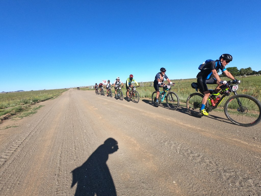
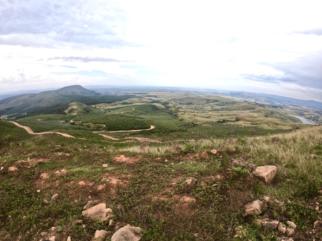
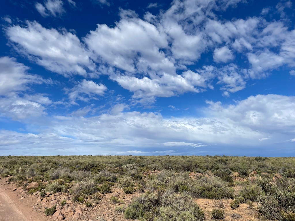
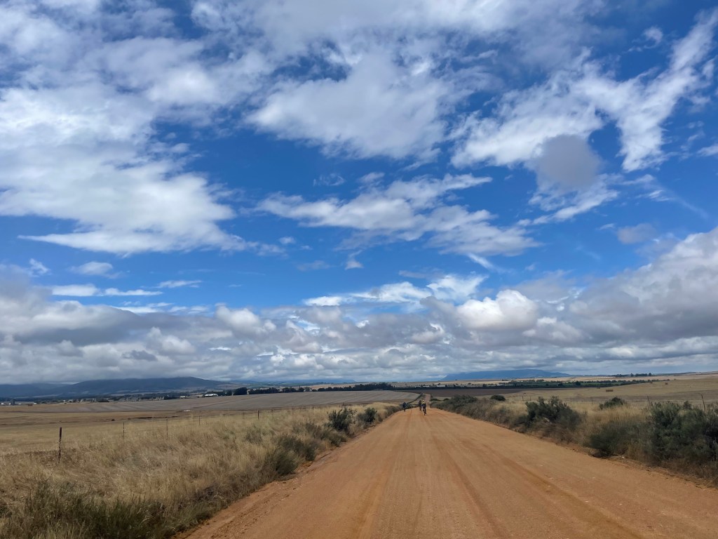
The first 100km southwest of Bloemfontein rather were monotonous. WP1 was at 60km and came and went quickly. Over the next 20-30kms we reeled in a few riders and, before we knew it, were at the head of a group of around ten riders. This helped to eat up some distance with the pleasant sound of whirring cassettes and crunching gravel under many wheels.

We were meant to be able to get water at the Steunmekaar police station at just over 100km, but for some reason best known only to our police service, there wasn’t any water available. Thankfully some farms close to the road a few kms on did have water and so we paused to refill given the big gap to WP2.

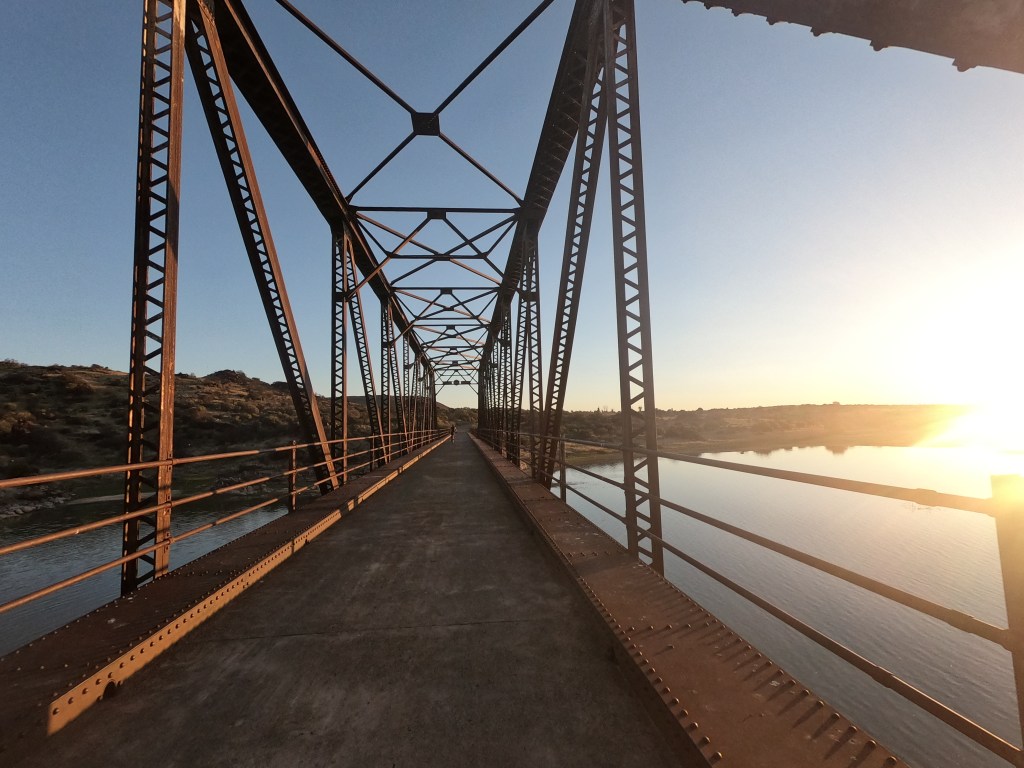
The old bridge over the Riet River a couple of hours later was the highlight of this first section given the beautiful sunset at that time.

We got to WP2 (30km west of Fauresmith) at around 21h30. Distance covered: 171km. Elapsed time: 9h30. It seemed like all we did was grab some food and refill bottles, but amazingly an hour had passed by the time Raymond and I finally left. We headed out into the darkness enjoying the cool evening temperature and the stars above our heads.

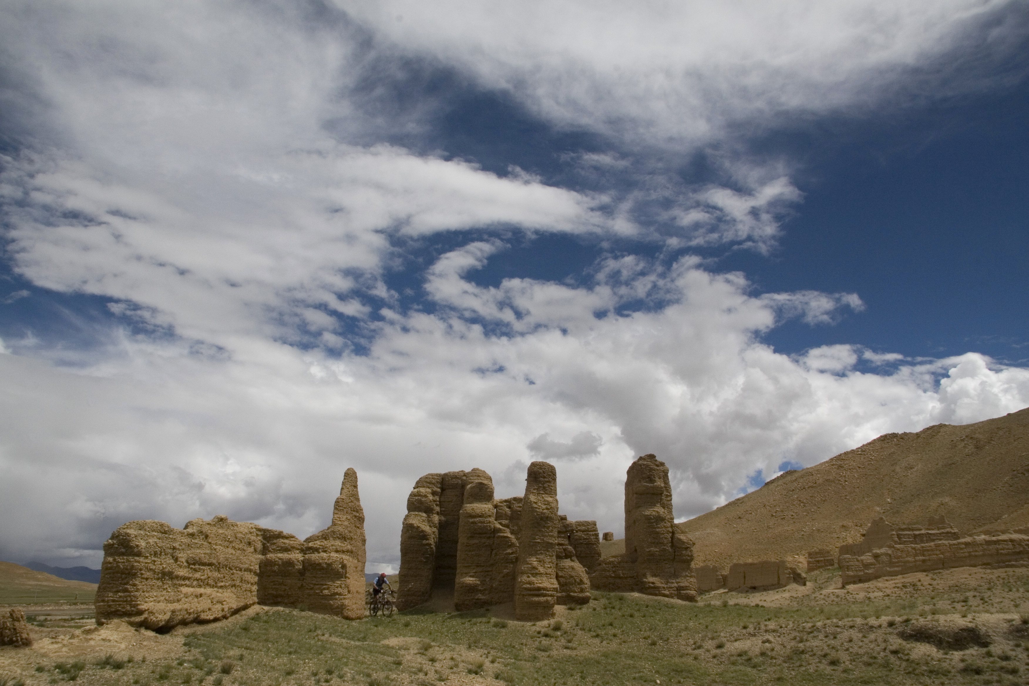
Our next stop was going to be RV1 at Vanderkloof at 224km. Unbeknown to me was that Vanderkloof isn’t just a tiny town in the middle of nowhere. It is home to the second largest dam (by volume) and boasts the highest dam wall in the country. So, I was a bit surprised when my Garmin started showing a large body of water on the map, which I couldn’t see in the pitch darkness around us. Shortly afterwards we entered what seemed like a deserted military base with high fences, large concrete structures, and a poorly lit road which narrowed down and then launched us onto the top of the dam wall.

It was particularly eery riding along the wall with a sheer drop on one side and a dark mass of water on the other side. And it was silent; no wind, no gushing water, no nothing. It was like being in a horror film waiting for something scary to happen… Well, nothing happened except that as we left the dam and its fortifications behind, we climbed a nasty little hill and then rolled into the sleepy and sleeping town of Vanderkloof. Oh yes, we had also crossed the Orange River, which meant we had left the Free State behind, and moved into the Northern Cape. Time check: 01h36, Day 2. Distance covered 224km. Elapsed time: 13h36.

It was never our intention to sleep at this race village, although I think the idea did seem particularly tempting for Raymond at the time. After some delicious pasta and chit chat with other riders I felt it was time to go. I had cooled down and was getting stiff. An hour had rushed past by the time we got going again and it took me a good half hour to warm up.

For most of the day we had been on lovely gravel roads, with a tiny bit of tar around Vanderkloof. Now we had entered the Rolfontein Nature Reserve (I had never heard of it before either) and were riding on a winding jeep track where some attention was required, not just from a navigation perspective, but also because the track was broken with ruts, rocks, and aardvark holes.

Alex had warned us about the holes these nocturnal animals dig out in search of ants and termites. Now Alex may be prone to some exaggeration at times, but he wasn’t joking about the size of these excavations! We dodged and jumped over a few that would easily have swallowed a full 29” wheel and have had space for the rider and some bags that would follow. Needless to say, it was not difficult to stay awake through this pock-marked area.

Shortly before we left the reserve, I spotted an aardvark. It was perhaps disturbed by our passing and lumbered off into the shadows, but not before Raymond confirmed the sighting. I was super excited by this rare sighting. I’ve spent many years scouring the veld looking for aardvark (and other animals) and have only had one distant sighting. And here was one only 15-20 meters away! Now, I realise that it was early in the morning, and after 14 hours of riding, but neither Raymond, nor the three riders who caught us while we had stopped, seemed to share my excitement. We pushed on.

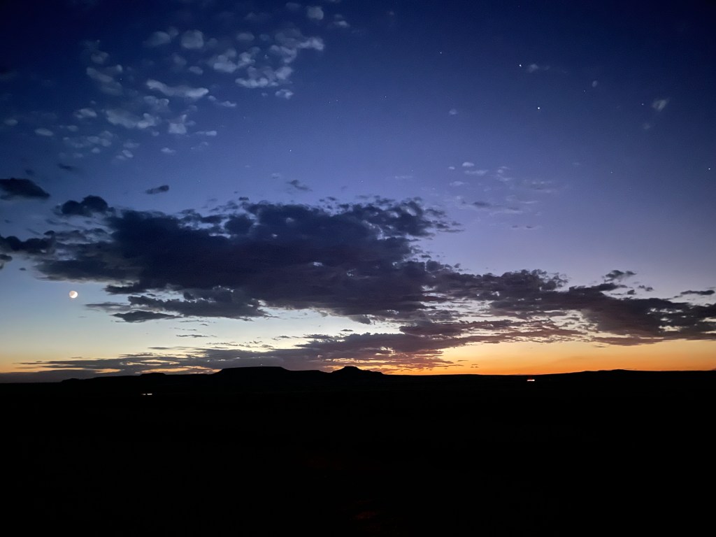
As the adrenaline from aardvark-hole avoidance, and the thrill of seeing one, started fading the eastern horizon changed colour. My favourite time of the day was approaching. I have always loved being awake before dawn to watch the darkness slip gradually away and be replaced by an ever-changing mix of colours, shadows, silhouettes and clouds which, before you know it, work together to deliver the dawn of a new day. And what a spectacular morning it was!

Dawn on day 2

It is amazing how one can feel one’s body becoming energized with the arrival of daylight. All of our circadian rhythms are slightly different, but from about 04h30 onwards I know I won’t have to worry about the sleep monsters anymore. With renewed energy, Raymond and I kept turning the pedals.

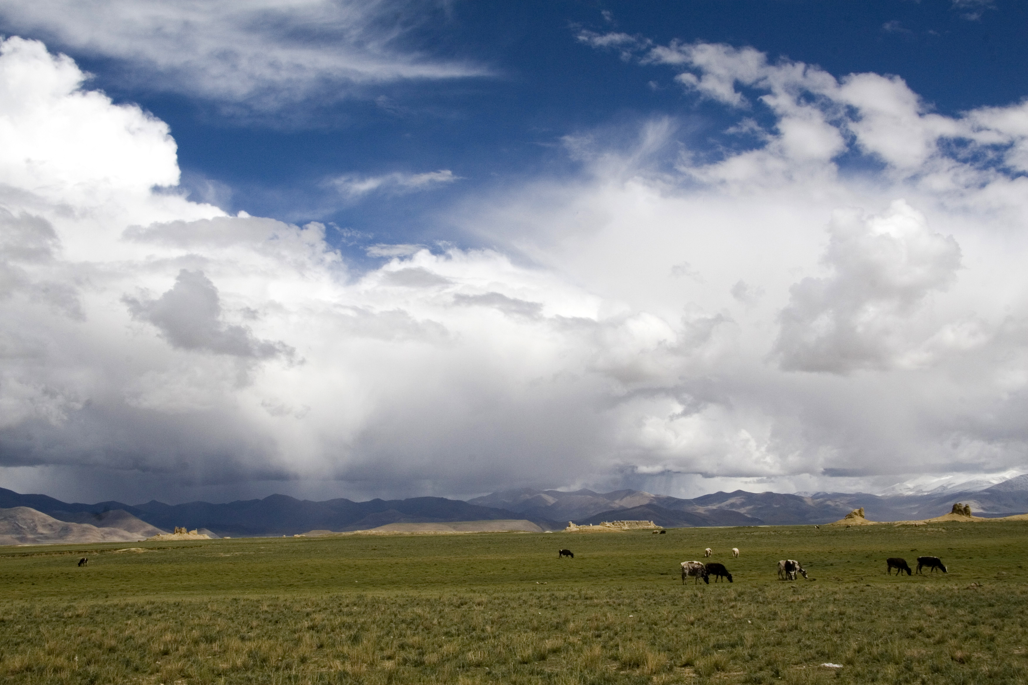
We were planning to stop at a reservoir near the 270km mark to eat and refill bottles, but a few kilometres before this we were delighted to find a friendly farmer who offered us water and conversation. A big sky and wonderful clouds carried us onwards for some time after that.

By the time we got to WP3 at 304km at around 07h45 (elapsed time: 19h45) I was nicely warmed up and keen to keep pushing on. The vetkoek with mince held my attention for some time and I washed these down with some fabulous coffee. Blissfully satiated I got ready to leave. On looking for Raymond I found him sprawled out on a well-used sofa. He wanted to rest for an hour or so and suggested I carry on without him. While we thought we might hook up again at RV2, it was in fact the last time I saw him during this event.

While I enjoy riding alone at times, there is nothing like some good company, especially when the road is long. I was joined a few kilometres on from WP3 by Wayne MacFarland. I had met Wayne at dinner in Bloemfontein on the night before we started, but we hadn’t had much chance to chat. We made up for that in the 40kms between WP3 and WP4; the distance flew by as quickly as the ground we covered in conversation!

I have a fond recollection of WP4. I was 343km into the ride and had been going for almost 22 hours. Although it was only 10h00 in the morning the day was getting warm and I really wasn’t looking forward to the 60km I had to cover to reach RV2. However, the toasted cheese and ham sandwiches and some Coke cheered me up immensely, and a quick dip in the nearby pool cooled me off. Suitably refreshed, I was on my bike after only a 30-minute stop.

Wayne wanted a longer break so I had set off alone into the growing heat and a stubborn headwind. I had an extra bottle of water and used it to wet myself intermittently as well as my buff. Before COVID I never liked wearing a buff, especially while cycling. On long gravel rides, however, I have come to enjoy this cheap and versatile accessory. It keeps the sun off my neck and, when wet, it does a wonderful job of cooling my neck too. In addition, I have found it super-useful to breathe through when conditions are very dusty. On hot days, particularly with a headwind, breathing through a wet buff seems to help prevent the sore and dry throat I would otherwise have developed.

The temperature continued to climb on the bleak road to Britstown and peaked at 38oC according to my Garmin. I drank 6 bottles on this 60km stretch and used an additional two bottles to douse myself. I was hot and bothered by the time I rolled into to RV2 but only too pleased to be in the relatively cool confines of the Transkaroo Hotel. Time check: 13h30. Distance covered: 403km. Elapsed time: 25h30.

An old acquaintance, Clinton Halsey, was also at RV2 and over some lunch we agreed to set off together at about 17h00.

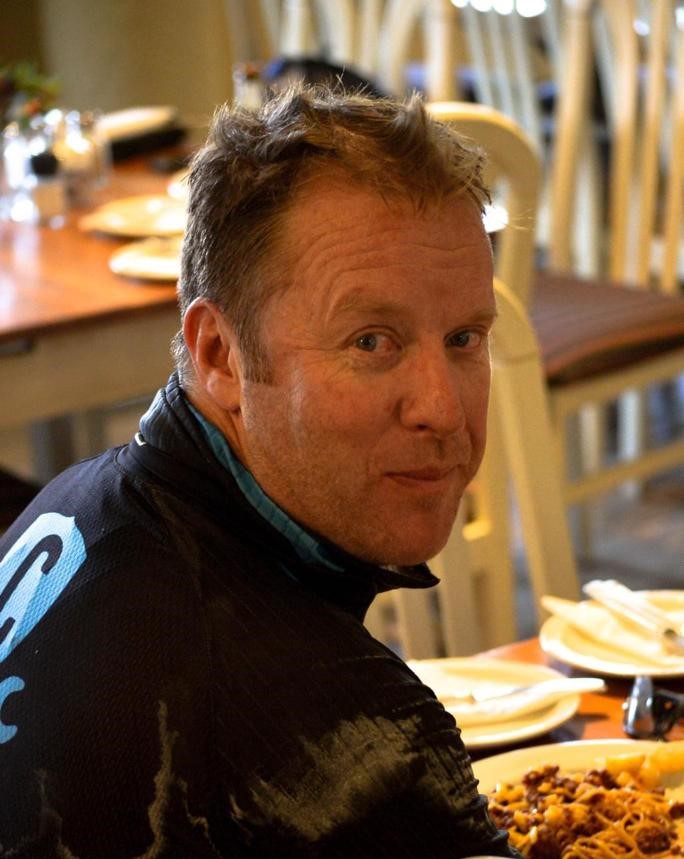
Here I am filling my face with some pasta.

(Photo credit: EP Digital)

I used the time to have a blissful shower and about 90 minutes of sleep. After catching up with family and friends, and a few cups of coffee, I started getting ready to hit the road. It was in fact closer to 17h30 by the time we headed out into the late afternoon heat. Amazing how 4 hours had just disappeared!

Clinton and I met in 2012 on a 1,000km bicycle trip across Nepal, with Alex Harris, and have bumped into each other at various events in the years since. He is a Munga legend having completed all 6 of the Mungas held to date and 2 of the 3 Munga Grits. He fell and broke his wrist in the most recent Munga Grit in October and pulled out at the 400km mark after riding almost 100km with his broken wrist. 8 weeks later he was on the start line in an attempt to keep his name at the top of the Munga ranking table. And here he was at the 400km point riding into the sunset with me in tow.


Read my post Across Tibet
A 1,000km bike ride across the Himalayas


After a spectacular pink sunset, which my photos did not do justice to, Clinton and I switched on our lights and settled into a comfortable pace. Well, comfortable for me anyway – it was clear that Clinton’s wrist was causing him some discomfort and he often rode with only his left hand, or with minimal weight on his injured right hand. To make matters worse, Clinton’s light started to flicker, but was better when his front shock was locked-out (i.e. disabled). This outcome, while being good for riding in the dark, did not help with his wrist.

Thankfully WP5 wasn’t too far away and we resolved to fix his light there. It had started getting cold and the wind picked up a lot, so the shed that was WP5 was particularly welcoming. Between cups of coffee and food (more vetkoek!) I helped Clinton strip down and repair some of the wiring of his dynamo light.

Note to self: as I also have a dynamo light, pack insulation tape and a spare set of electrical connections. Using duct tape on thin electrical cables made for a sticky mess… but one that seemed to do the trick. After at least an hour of stoppage we set off with two functioning lights. Time check: 21h35. Distance covered: 440km. Elapsed time: 33h35.

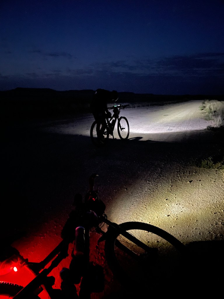
I really enjoy riding at night. One is very focussed on the road in front and the small amount of light delivered by one’s bike lights, even if riding in a group, does not extend very far out in front. This means that one rides in a relatively small illuminated bubble. The benefit of this, in my mind anyway, is that you can’t see a hill looming up in front of you, or how long the hill you are on actually is.

You just have to get on with it and pedal!

We made steady progress despite the increasingly blustery wind. The temperature dropped quickly and we were cold by the time we were blown into Piet and Lola’s farmyard at about 01h00 on Day 3 (3rd of December). Distance travelled 485km. Elapsed time: 37h00.

We found some shelter in the generator room where another chap was trying to sleep under his space blanket. I couldn’t tell whether it was the wind or his shivering rustling the blanket. This was no place to hang around! After sorting out our bottles, some warm clothes and a bite to eat, we headed off into the darkness and the wind. The temperature dropped to 8 degrees but with the wind-chill it felt colder than this.

I don’t think Clinton believed me at first when I told him it was my birthday. Or perhaps he had to hold himself back from saying that there seemed to be better things to do than ride through a gale, at night, in the middle of the Karoo. It was certainly a novel way to spend my birthday! My present from The Universe was seeing a porcupine running next to the road (a sighting which was confirmed by Clinton).

After that though, the night became a bit of a blur. I know we joined up with Nico Coetzee (more about him later). I distinctly remember many bushes. Their shadows moved like porcupines of all shapes and sizes as our lights passed them. I could also swear I had seen a coiled-up snake next to the road. The others hadn’t seen it and we didn’t go back to check out this particular sighting. In retrospect it was clear that the sleep monsters were at work, introducing hallucinations into my foggy brain, while intermittently trying to persuade me to have a long blink… I nearly rode off the road a few times and eventually had to stop for a few minutes lest I did actually fall asleep and crash. Out came the headphones and dance music; with Armin van Buuren blaring at full volume I managed to get myself safely another 3km down the road before falling into WP6. Time check: 04h00. Distance travelled 528km. Elapsed time: 40h00.

WP6 is not really meant to be a sleep-over spot. However, the sheer demand from weary riders looking for a place to crash prompted the owners, who have hosted the Munga over many years, to build an extra wing onto their property. This was already full when we arrived, but extra mattresses were found and I had a wonderful 90-minute sleep on the floor in the lounge of the main house.

We woke at 06h00 and, with the sun already up, there was a high level of activity as riders emerged from various corners of the house and busied themselves with breakfast and moving preparations. After a second bacon and egg roll (don’t judge, it was my birthday after all!) and a double espresso, we saddled-up.

The wind had abated and it was great to be out in the fresh morning air. I felt good and was also riding into uncharted territory – every kilometre completed from now on would be the most I had even ridden. I had Johnny Clegg’s song African Sky Blue on my mind. What a great way to start the day!

Under African sky blue

Our next stop would be RV3 located just outside Loxton at 598km. While it would be tempting to rejoice at crossing the halfway mark, I knew that the mental halfway point was still a long way ahead of us. Little did we know quite what lay ahead…

But for now, the roads were excellent and Clinton and I made good progress. The 70km to RV3 passed without incident, although the detour through some farm tracks when a perfectly good bit of tar road went to the same place did stimulate some unprintable descriptors of Alex Harris.

The Jakhalsdans farm which hosted RV3 had really put together a fantastic stop inside one of their big sheds. I had possibly one of the best lasagnes I can remember as well as some excellent coffee. Clinton bought a spare light from the mechanic based there, just in case our repair job failed (it didn’t). He also bought me a present – a spare water bottle as I’d left one of mine in the dark at Piet and Lola’s farm. It was getting hot and so I was very relieved to be back to a full complement of 3 bottles. Time check: 10h30. Elapsed time: 46h30.

We had a tailwind for some of the 54km to WP7 which one should never begrudge, other than that it seemed to amplify the ambient heat and soon I was dripping with sweat. Thankfully we passed a reservoir with deliciously cool and clear water shortly after midday. Without this refill I would no doubt have been in trouble.

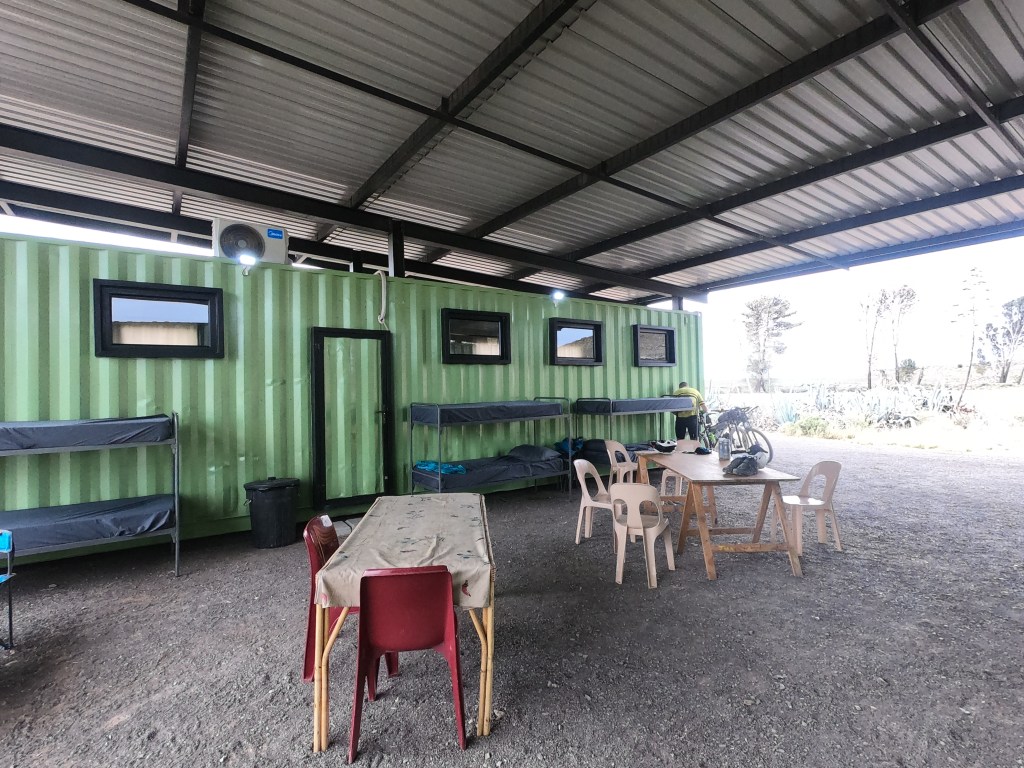
The farmer at WP7 put a few containers together with a covered roof between them and created a wonderful spot to put one’s legs up for a bit. The one wing has showers and a kitchen, while the other side has an air-conditioned dormitory.

The shower was much needed and helped me reduce my core temperature. Sadly, the air-conditioner was struggling to cope with the heat and sleep was impossible. So we sat outside enjoying the breeze that blew between the two wings. This helped cool us down and dried out our washed cycling kit while we waited for the heat of the day to pass.

At about 17h30 we wrenched ourselves away from this little oasis and hit the road, this time heading for Fraserburg. A headwind was getting stronger. Clouds built in the west, making for a dramatic sunset. From about 10km out of Fraserburg we could see the street and house lights flickering lazily at the base of low hills. Like a mirage on the horizon, they simply didn’t seem to get any closer.

Storm clouds building en route to Fraserburg

Fraserburg is not a big place. It is home to about 3,000 people, all of whom seemed to be safely inside on this stormy Friday evening, despite it being only 19h30. Distance travelled: 700km. Elapsed time: 55h30.

We stopped at Clinton’s favourite corner café and bought a few things we wouldn’t have found at the waterpoints: Stoney Ginger Beer, packets of crisps and even samoosas. These were devoured while we made use of the rare mobile phone signal to speak to our families. 45 mins later, with extra layers on, we headed out of town on the main dirt road towards Sutherland which was about 115km away.

Clinton had warned me about the section we soon found ourselves on at around the 715km point. While we had been on the R356 gravel road, which was like a tarred road, we had turned off this onto rough surface. For almost 30km we wound our way around various farm tracks, a steep downhill section with loose shale, a narrow gulley which would have been easily missed even in day-time, and lots of farm gates. This was accompanied by light rain that made the track more sketchy still.

The constant opening and closing of farm gates was an irritation that prevented one getting into a nice steady rhythm. It did, however, keep me awake as they seemed to appear out of nowhere, always heralded by a little reflective “Close the gate” Munga sign. Clinton’s injured wrist made getting on and off painful for him, and so it became my job to dismount, open the gate, let him through and then close the gate while he held my bike. If all the gates had been the same, with the same locking mechanism, this little routine would have become boring very quickly. However, I can safely say that there are no two gates that are the same between Fraserburg and Sutherland!

We got to WP8 at around 01h00 (Day 4) in heavy rain. Distance travelled 749km. Elapsed time: 57h00. It was lovely to venture inside to find a kitchen warmed by an old Aga. This venue had numerous tents in the garden, all of which were full. So, extra mattresses were placed in the kitchen and it was here that Clinton and I enjoyed some boerewors rolls and cooldrinks. On hearing that it had been my birthday, our gracious hosts even offered me some Old Brown sherry. I obliged heartily and then had a wonderful, warm, 90-minute sleep. We were roused by the arrival of a few other riders, and as the rain seemed to have stopped, decided to get going. The warm kitchen had thankfully dried my damp cycling shirt and so I packed away the dry base layer I’d slept in.

Soon thereafter we re-joined the R356, which really did beg the question ‘why were we made to take the scenic gate route’? More unprintable adjectives and names for Alex.

The bad weather did not dissuade the sleep monsters from tormenting me between 03h00 and 04h30. My unsuccessful attempts to strike up conversation with Clinton suggested that these same monsters were wrestling with him too. There was nothing for it but some more loud music! Soon enough the loud tracks from Def Leppard’s Hysteria album did the trick. Or perhaps it was my singing? Either way, the sleep monsters were gone.

Sadly, so was Clinton. Unfortunately, during this mental torture we had probably both been through, he had dropped back and his light, though visible, was some way behind. With the eastern horizon slowly getting lighter I decided to ride on and wait for him at RV4 in Sutherland. At some point, shortly after dawn, the R356 became a tar road. What bliss! But also what boredom. The sleep monsters came back, although daylight robbed them of their strength.

I had some patchy mobile phone signal and, as it was around 06h00, decided to phone my wife and then my parents. While these were relatively short conversations, they chased away the sleep monsters and brought me safely to the outskirts of Sutherland. I had now been going for about 66 hours and had covered 812km.

I could have stopped and slept here. It was a race village after all. However, the weather was cool with light cloud cover and no wind. Perfect conditions for riding. I had some pasta and coffee for breakfast, refilled my bottles, lubed my chain and got ready to leave. Clinton rolled in looking somewhat grey. I shuddered to think how sore his wrist must have been after what we had been through in the night. He wanted to rest up for a while and wished me well.

I was sad to leave him behind. We had ridden so easily together for over 400km. Under normal circumstances I wouldn’t have been able to keep up with him, and so I was grateful that his handicap had afforded me his companionship for best part of 40 hours.

The road southwest of Sutherland was somewhat familiar given that we had ridden the route (albeit from the other direction) in the Munga Grit in April. I enjoyed the open space, the blue sky and the strength in my legs. Time check 08h28.

After a fantastic descent dodging large holes and ruts in the road, I reached the valley that would lead to Ouberg pass. This pass would see us drop almost 700m in altitude. My kind of riding I thought excitedly. In my excitement I took a wrong turn up the road that the Munga Grit had come along, and by the time I realised my error and retraced my steps I had been passed by Nico. I caught up with him and shortly afterwards we came across Guy Jennings who was struggling to seal a puncture. We tried to help him, but it was only with the arrival of Daniel Paolses, who carried extra strong tyre sealant, that the tyre was successfully sealed. I do wonder whether Guy will ever be able to remove that tyre if needed…

Nico and I carried on together. In the intervening time the weather had changed dramatically. Dark clouds with thunder and lightning approached rapidly. Time check: 08h56.

There was no time to be lost. We had some way to go, along with a sharp climb to negotiate, before the Ouberg descent and by the time we got to the pass it was raining.

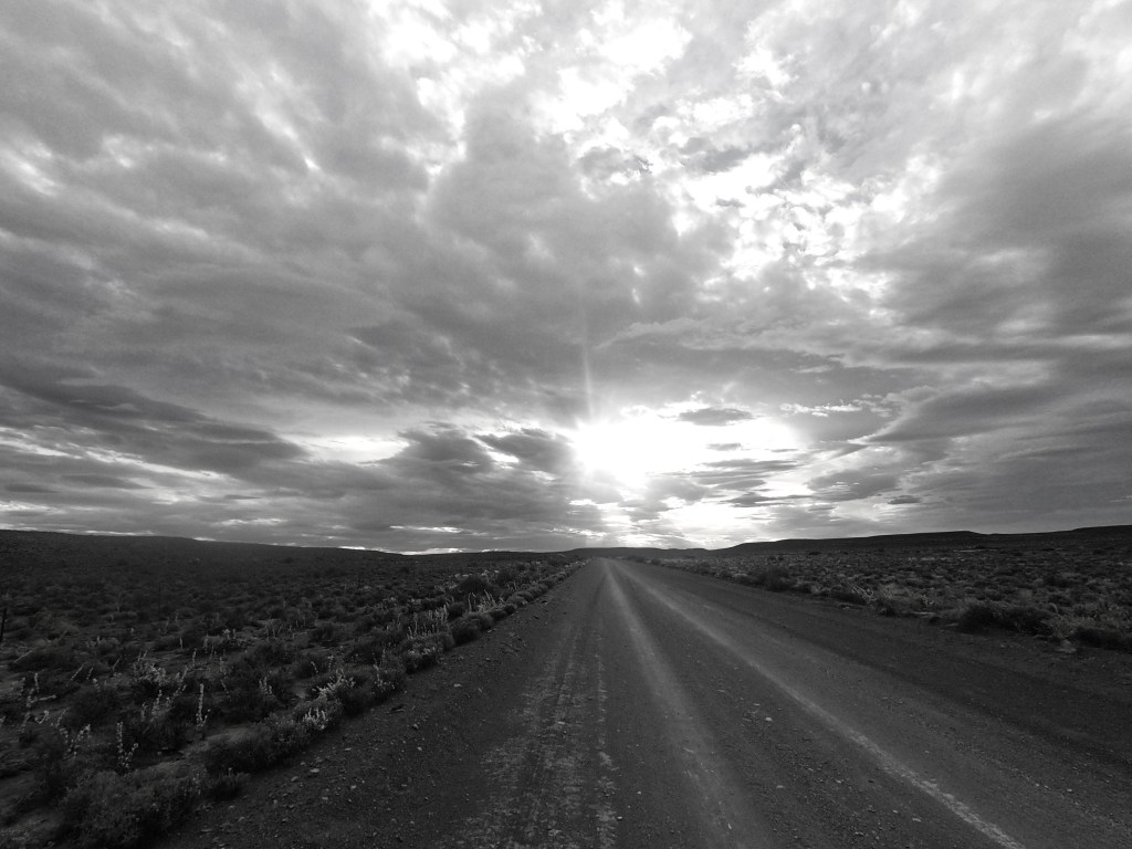
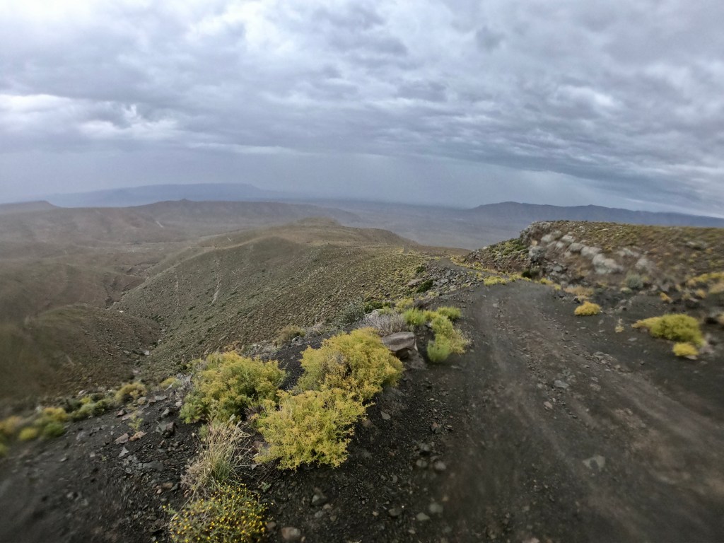
The poor quality photo above was taken perhaps a third of the way down the pass in the pouring rain. What should have been an adrenaline-filled technical descent quickly become dangerously wet. Time check: 10h05.

Once off the mountain we were thoroughly drenched during the 15km before getting to WP9 at the Tankwa River Lodge. Lightning strikes and thunder-claps were all around. I pitied those attempting the pass behind us. The lodge at WP9 is a lovely place to spend some time. There is a pool and deck on which I could visualise drinking a cold beer on any normal day. Time check: 11h00. Distance travelled: 873km. Elapsed time: 71h00.

But this was not going to be a normal day.

I changed into my dry base layer and ate some pasta while chatting to our friendly hosts. About 20 minutes later there was a break in the rain and the sky seemed to get brighter. It felt like a good time to get moving. I toyed with the idea of wearing my warm base layer, then rejected the idea. While I was wrestling with my wet shirt, much to Nico’s amusement, we cheerfully bade our hosts farewell.

We followed the undulating road next to the Tankwa riverbed for some kilometres. We thought we had timed our departure well… we were very wrong. For the next hour we again got exceedingly wet.

The road conditions become horrendous with water running everywhere. What should have been a smooth gravel road become a sticky mess. Lightning-strikes posed a grave danger given that we were probably the tallest things in a 50km radius. Time check: 13h05.

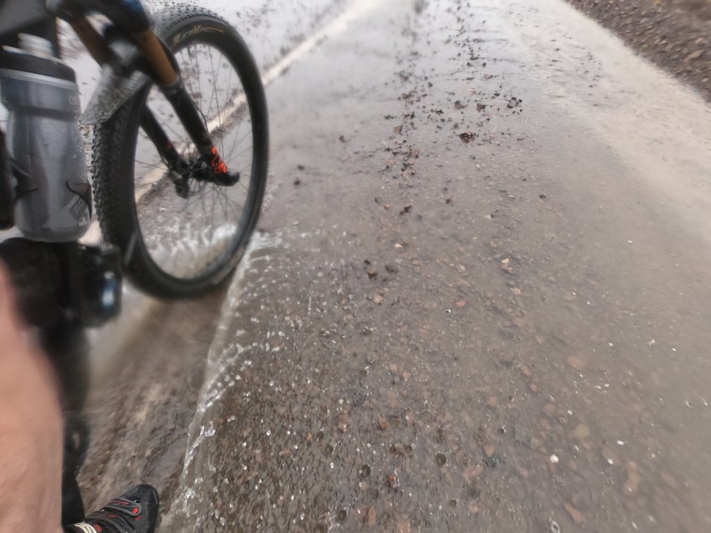
We rode on. What else was there to do? For at least another hour it poured. We seemed to be climbing non-stop. With a slight tail wind, I was too hot with my rain jacket on, but too wet to take it off without getting cold again. Eventually the rain seemed to ease and then, as quickly as it had arrived, it was gone. We could hear a constant rumbling sound – it was rainwater rushing down the streams and rivers alongside the road and even across the road in front of us in places.

What we didn’t know, was that behind us, all of the water we had witnessed and ridden through, was converging near Tankwa River Lodge, resulting in a 100-year flood that for hours trapped some riders, including my friend Raymond, on the wrong side of the torrent. We climbed, oblivious to this development, and were thankful for the clearing sky in front of us.

The trouble with the Tankwa Karoo is that, in my experience, one seems always to be riding uphill. I noticed this in April while doing the Munga Grit, and I was going in the opposite direction! It reminded me of the Penrose steps illusion, sometimes called the impossible staircase.
(diagram source: Wikipedia)

The other problem with the Tankwa is that it is invariably very hot and bone dry. Given the earlier rain, I hoped to escape the heat, something I worried about beforehand as there are no water points on the 95km to WP10. With about 45km to go, it became clear to me that I was not going to be fortunate. The clouds disappeared, the temperature rose, and the wind blew into our faces.

Now, my current riding partner Nico is a hard man. I knew this because, while I felt quite smug at having ridden about 900km, I had learned that Nico had already ridden from Cape Town to Bloemfontein prior to the Munga start. That meant he had already covered over 2,000km! This fact played with my mind, particularly because he appeared to be so much stronger than me on the climbs. He was also a man of few words. I tried to converse with him in my broken Afrikaans and he humoured this despite his far better English. Our silences became more prolonged. More Penrose step torture followed. The sun was back out in force.

I don’t quite recall when it happened, but Nico dropped behind, and after some time was not visible behind me at all. Perhaps he had stopped for another “standing sleep”. He told me this had happened earlier today on the road to Sutherland. Those damn sleep monsters got to him too!
I was all alone in the Tankwa.

I joined the main road south, the one that eventually leads out of the Tankwa to Ceres. From here I had about 24km to WP10. While this should have been a relief, it was quite the contrary. I rode into a headwind with the temperature approaching 40 degrees. More concerning was that I was almost out of water. Time check: 16h30. Distance travelled: 944km. Elapsed time: 76h30.

I noticed a bakkie coming along the road towards me. It stopped and two people jumped out. A coolbox was lifted from the back and before I knew it, I had cold water and some Coke in my bottles. These kind folk were manning WP10 and had come back down the route offering water to all the riders. Pure happiness!

An hour later I was only 10km farther. The relentless wind tried to push me back to the Ouberg pass. I resisted, but the constant uphills and false flats gave me little respite. I even had to pedal on the few short downhills of the undulations to get to a speed above 10km/hour. I finished two of my bottles and was again concerned that I would run out of water in the remaining 15-16km given that they might take another 1-2 hours at my current rate.

I stopped briefly at a signpost with no sign on it. I was alone, on the road to nowhere. I wanted to have a little cry. But this seemed pointless….
This was no time to cry.
Nobody would see me.
Nobody would provide comforting words.
Nobody would care.
Time check: 17h37.

No time to cry

The time for self-pity was not now. Not here. There was nothing to be gained from stopping here, I told myself. Nothing for it but to keep pedalling. There was no mobile signal, so no calling family or friends. Just me, a wild landscape and never-ending hills.

I set off. Uphill, again. The wind was worse. It caused a deafening roar that meant it was pointless to put earphones in.

Now, I’m not a religious person. But on days when I’m out in the middle of nowhere, particularly when amongst mountains, I feel spiritually awakened. I feel at one with my surroundings, intensely focussed on the task at hand, and bereft of the everyday noise and stresses that can fill my mind. This was not one of those days.

Instead, my mind was filled with a song that wouldn’t go away. Joan Osborne was crooning “If God had a name what would it be…” and “What if God was one of us…” on repeat. “Just a stranger on the bus, trying to make his way home…” “Yeah, yeah, God is great…” Round and round and round in my head. Some might suggest this was a religious awakening moment. I found it neither religiously nor spiritually uplifting.

I was suffering mentally and physically. I was in the dark depths of despair, self-pity and self-doubt. My body was tired and weakening due to prolonged effort and early stages of dehydration. I was all alone, just trying to make my way home. But, despite the tricks my Garmin seemed to be playing on my brain, I knew that each pedal stroke brought me closer to home. And so, I just had to keep pushing the pedals over, one small circle at a time: pedal… closer… pedal… closer still… pedal…

All bad things come to an end. The road finally ran out of hills and I saw the Tankwa Padstaal about 2km away. The wind howled and those few kilometres seemed to take ages to finish. But soon enough I parked my bike next to the shed that was WP10. It was the first time I’d been out of the wind in hours and my ears rang as if I’d been in a nightclub.

I had been so focussed on the road in front of me that I had barely noticed the darkening skies around me and the distant rumbling of thunder. No sooner was I inside the shed than it started pouring with rain. Time check: 18h50. Distance travelled 968km. Elapsed time: 78h50.

While my legs still felt ok, my mind was shattered. Some vetkoek and mince helped, as did a few cups of water with Coke. It seemed difficult to comprehend the array of weather conditions and emotions (mostly correlated with each other) that I’d experienced in the last 18 hours since I enjoyed some Old Brown sherry. The Karoo is meant to be hot, dry and windy. I’d had plenty of wind, but I’d also been cold, wet, hot, very wet, very hot and almost very wet again. I’d been elated, excited, cheerful, sad, joyful, scared, relieved, in deep despair and extraordinarily grateful. Meteorologists and psychiatrists would have had a field day indeed.

From the weak Wi-Fi signal at WP10 I learnt of the biblical floods 100km back in the Tankwa and the problems these were causing. I was therefore grateful for the roof over my head and the warm clothes I had on. I also bumped into another acquaintance, Justin Bark, who had arrived earlier in the afternoon with his two friends Leon Tobias and Mark Sack. They had wanted to set off around the time I had arrived, but the heavy rain had stopped them. We agreed to sleep for a while and review the conditions at 22h00.

I had some more vetkoek, messaged friends and family to assure them of my safety and improving well-being and drank plenty of water.

There were not many other people in the hut, perhaps 8 in total, excluding the support staff and their family. I arranged my things at the head of my mattress, stuck in my earplugs and put my eye mask on, and fell asleep.

I was woken by Justin at 22h00. He told me it was still raining and that we should wait a bit longer. I surveyed the dimly lit hut – there were bodies everywhere. Clinton, who must have arrived after I’d passed out, was fast asleep next to me, as were two other chaps. There must have been 20 bodies strewn around the place. It was like a refugee camp! I asked one of the support staff if he would wake me once the rain stopped, and then crawled back under my blanket.

At around 23h30 I woke with a start. It was very quiet, and very dark in the shed. There was no rain beating down on the corrugated iron roof. For a few moments I thought perhaps everyone else had left without me. They were, in fact, soundly asleep. As was the chap who I had asked to wake me when the rain stopped. I couldn’t blame him – the support staff had been awake for two days since the leaders first came through here.

I got up and started gathering my things. While I had left them neatly at the head of my mattress, the newcomers had moved things around a bit, and it took some time to find all of it, particularly without waking the whole place up. I tried a few times to wake Justin gently, to no avail. A rigorous shake of the shoulder did the trick, and he was as bewildered as I had been a few minutes before. But he did get up, along with Mark and Leon. I also woke Nico who had also materialised while I was asleep. On waking Clinton, I was asked what the rush was? I said something about being worried about the time and the weather, to which he shrugged and rolled over.

At around midnight Justin, Leon, Mark and I headed outside. The car park was a mud bath and so our feet quickly got wet. The rain had stopped but we set off into a fine mist, with a gentle tailwind. It was 100km to Ceres and there was plenty of climbing involved. It took us all a while to warm up and once we had I was riding with Mark, while Justin and Leon had drifted up the road ahead of us. The road conditions were again very wet, muddy and sticky. I was also too hot with my jacket on, and yet too cold when I took it off. I resolved to keep the jacket on but unzipped.

Nico came past us without saying much and simply disappeared up the road in front of us. A hard man indeed.

Mark and I were well matched in terms of pace and the consistency thereof and we chatted easily about many things. But all good things come to an end too. I had repeated visitations from Joan Osborne as well as Jeff Buckley’s acoustic version of Hallelujah. It’s a great track, but there is a time and place, right?!

The sleep monsters made a valiant attempt to get me into the shrubbery along the verge. A rather nasty climb which started at around the 1,000km point required some keen attention and loud music. The 500m in altitude gained during the climb would have been difficult enough on a midweek coffee ride, but at 03h00 on a misty morning with a 1,000km in the legs… well, it wasn’t a pushover! I used my granny gear for a long time and had to zig-zag around to maintain momentum. This, along with the mist, made for a wholly disorientating experience.

The trio I had set off with had dropped me up this climb, but graciously waited for me at the top. We didn’t hang around and carried on riding. Not long after this the first signs of dawn appeared. As we descended, we moved below the mist and onto a tar road. We sped along getting cold from the speed, but carefree in the knowledge that the biggest climb of the ride was done, and that Ceres lay not too far away.

Shortly after this, another fast descent was rudely interrupted by my Garmin indicating an impending 90-degree left turn. My heart sank with the realisation that the route wasn’t going to follow the tar all the way into Ceres, but was going to take us on a longer dirt road detour via Eselfontein. More expletives for Alex.

RV5 was at the high school on the outskirts of Ceres. We were rather damp and muddy, but in high spirits. We‘d had a relatively good ride weather-wise from the Tankwa Padstaal and it was less than 100km to the finish. Time check: 06h20, Day 5. Distanced travelled: 1,065km. Elapsed time: 90h20.

Shortly after we arrived in Ceres the heavens opened and things got very wet. Thankfully we were enjoying breakfast and coffee at the time. We settled down on some spare mattresses and waited out the squall. 45 minutes later the rain abated and we prepared to leave.

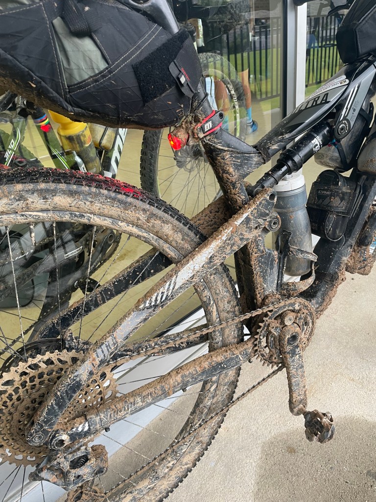
The race village mechanic had kindly washed our bikes down – they were in a terrible state given the road conditions since leaving the Tankwa.

I would love to say that the last 90km to the finish was a doddle, but that wouldn’t be true. While some of it was on tar roads through Mitchell’s Pass and the Nuwekloof Pass, the dirt roads after that were wet and sticky, and mostly uphill. The early morning cloud dissipated and was replaced by broad sunshine and humidity.

The final stretch between Ceres and Wellington

But it has to be said that the scenery was lovely and the company pleasant. Justin, Leon and Mark appeared to be stronger than me in those final kilometres, and yet waited patiently for me despite there being no reason for them to do so. Perhaps they waited because this was the Munga and we had all suffered in our own way to be where we were. Perhaps they were just grateful that I had woken them some 9-10 hours earlier. Slowly but surely, we got to the line at the Doolhof wine estate, about 5km outside Wellington.

I should not have been surprised that the finish was at the top of a hill. I must really challenge Alex to find a wine estate further up a hill than Doolhof, as there must be one….
But I digress – crossing the finish line was as delicious as the beer that I had shortly afterwards.

Time check: 13h33 on Sunday 5 December. Total distance covered: 1,154km. Elapsed time: 97h33.

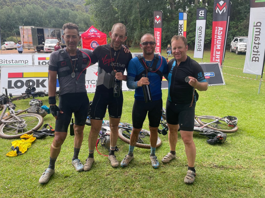
At the finish with Leon, Mark, Justin and myself (from left to right)

From all accounts, it seems that we had a more pleasant ride to Ceres, and beyond, than those behind us. I suppose that is the outcome of the dice that one constantly rolls on an event like this. I had some bad weather and some good weather. I made the most of what was in front of me, and the times when I felt strong and awake. I couldn’t know whether my conditions were better or worse than those in front of, or behind, me. I am satisfied to know that they were probably different from mine. The Toughest Race on Earth had dealt out something for each one of us.


Post-script:
Clinton Halsey finished his 7th Munga at about 16h00 on the 5 December. He remains the only person to have completed all 7 Mungas held to date.
Raymond Blake finished at about 23h00 on the 5 December after being delayed by the flooding in the Tankwa and by the heavy rain in the Tankwa and Ceres.

Thanks:
Thank you to Paulo Pinheiro from Carbon Bike Repair for your support and sponsorship. Thanks also for driving us to Bloemfontein. And then leaving us there.
It wouldn’t have been possible to do this event without the love and support of my family. To Toni, Alasdair and Ben, thanks for supporting my big audacious goal. Thanks also to my parents and friends who spent many hours dot-watching and sending encouraging messages.
To Clinton Halsey – you are the Munga Legend. You have inspired me to do the event and you define toughness by finishing it again, despite your handicap. Thanks for the many enjoyable miles together.
To the many farmers, their families, the paramedics and many other volunteers, thank you for the wonderful hospitality, food, conversation and other comforts on our journey from Bloemfontein to Wellington. Thanks also for the access to your farms, houses and water.
To Alex Harris – without you there would be no Munga at all. You have inspired me over the years with your various exploits and I’m glad to able to add the Munga as one of mine. I didn’t find much silence en route… but I did find companionship, suffering, inner strength and sleep monsters. For all of these I am indebted to you.


Equipment:
Momsen Ultra Vipa carbon frame
Fox 32 Factory 100mm fork
SRAM XX1 Eagle 12-speed, gearing 36×10-52
Hope Mason X 29” hoops
Son 28 dynamo hub
Continental Race King 2.2 tyres
Zipp Vuka clip-on tri bars
Brooks C17 saddle
Revelate saddle and top tube bag plus a stem bag
3 x 0.75l water bottles, all in the frame triangle using a Lyne Holy Rail with dual-cage holder

Toolkit: multi-tool, tube, bomb x2, adaptors, tubeless plugs, chain quick link, derailleur hanger, tyre lever x2. Pump. 60ml bottle Stans No Tubes tyre sealant. Leatherman multi-tool. Small roll of duct tape.

Electronics: Exposure MaXx D MK13 or Revo dynamo front light with RedEye rear light, Garmin 830, Sinewave Cycles Revolution dynamo hub USB charger, 3 000mAh Cinq 5 smart battery. Phone with wired Bose waterproof earphones.

Nutrition: Carry a mix of Hammer raw bars, Farbars, ButtaNutt squeeze packets, salted peanuts and some droewors. At water points I ate almost everything on offer (except bananas).

Hydration: Mostly used Nuun tablets dissolved in water and an occasional Coke. Double espressos at water points.


This story was first published in the summer
Cape Epic 2022 edition of Mountain Bike

Across Tibet

A bicycle tour from Lhasa to Kathmandu, August 2012


This story is from the days before Strava… remember those? I took a journal and a camera with me, and have used these as the basis for this epic ride across Tibet. This inaugural trip across Tibet was arranged by Xplore and its indomitable founder Alex Harris.

Alex continues to offer this trip, amongst others.
For details visit www.xplorethisworld.com


I first heard about the idea to ride across Tibet to Everest base camp while finishing a 2 week trip around New Zealand with my family in October 2011. The opportunity to head to a bucket list destination and to ride 1,000km across the Himalayas was one not to be missed and so I signed up. My training since then had been progressing well, but shortly after starting day 3 of the iconic sani2c MTB race in May 2012, I fell, landing hard on my butt. Shaken and in pain, I carried on to the finish.

A week later I decided to go for x-rays, followed by a CT-scan, as I was still very uncomfortable and had dark bruising around my hips and buttocks. The scans showed that I had compression fractures in my sacrum, which explained why I found it hard to sit down on my saddle. I was advised not to ride for 8 weeks, which felt like an eternity! After 6 weeks of convalescence I found that I could manage short rides without much discomfort, and so started to pick up my training again. However, I had only about 7 weeks before we set off for the Himalayas, and I felt really undertrained as the departure day approached. The story picks up once we had arrived in Lhasa.


11 August 2012, Lhasa, Tibet

The day started off very slowly. There were plenty of sore heads around the breakfast table at the Hyatt in Kathmandu. This mostly had to do with our sightseeing trip into Tahmel yesterday afternoon, which turned into a tour of not just the tourist markets, but also the many bars in this old part of town.

After breakfast we headed to the airport to catch our flight to Lhasa. Getting through security seemed to take forever, but soon enough the flight was called for boarding and actually left ahead of schedule. I had a window seat which was worth its weight in gold. Our flight path took us right past Lhotse and a partially obscured Everest. The peaks seemed very close indeed, despite our cruising altitude of almost 10,000m. Majestic!

View of Everest and Lhotse from my window seat

After landing at the new Lhasa airport it took us hours to clear the immigration and customs checks. Every single bag was scanned and searched. We had been forewarned not to bring any maps and guide books, and so all 16 of us were finally permitted to carry on outside. An air-conditioned bus then drove us into town, along a very impressive newly tarred motorway. As we drew closer to the centre of town, the impressive Potala Palace could be seen from its elevated and prominent position above the city.

We checked into a very average hotel, before heading out to get a bite to eat. Over many courses of good Chinese food Alex briefed us on the trip ahead and logistics for the next few days. Most of us then headed to bed – the effects of the night before, and the altitude (Lhasa is at 3,650m above sea level), made for an early night.

12 August 2021, Lhasa, Tibet

I awoke feeling largely unaffected by the altitude other than a slightly raised pulse and shortness of breath when climbing stairs. After a reasonable breakfast of fruit and an omelette we met outside to assemble our bikes, which had arrived with our support crew after a 24 hour drive from Kathmandu to Lhasa. Most of our bikes seemed to have survived the trip reasonably well and after some minor adjustments were ready to roll. A few extra parts were required and so we headed across to a local bike shop, mostly stocked with Merida stuff. This should have been a quick trip, but with a large cohort of cycling fanatics, this was like inviting kids into a candy store.

It was lunch time when we finally left the store, and my good friends Grant and Andrew and I decided to take a scenic route through the bustling street markets to find some food. While taking photos in a large square we were befriended by young man who had ridden his bike from Mongolia to Lhasa and was curious as to what trip we were doing. Despite his broken English, we chatted about his travels while we strolled and rode through the streets. We invited him to join us for lunch, which was handy given that most people we had met in Lhasa so far couldn’t speak English. We parked our bikes up outside the small restaurant we found. Our Mongolian friend, Yan, insisted on using his small bike lock so we locked Grant and Andrew’s bikes together, while mine was leaned up next to the door next to our guest’s bike. I could see one of my bike’s wheels from where we sat near the door, and so we settled into a meal of dim sum, noodles and beer.

A short while later we were interrupted by an elderly woman begging for some money. After she had departed I realised that I could no longer see my bike wheel, and, on rushing outside, found that my bike was gone!

To travel half way round the world to do a bike tour, and be so close to starting off, only to have one’s means of transport stolen from under one’s nose was gut-wrenching. I should have been more cautious for sure, but I simply hadn’t thought about crime since I had arrived. I would never have left my unattended back home in South Africa…

Most street corners and intersections have police stationed at them, as well as a multitude of security cameras, and so I asked Yan to help me explain to the police what had happened. We were taken to a formal police office a short distance away where we were interviewed again, and many phone calls were made. Everything was quite casual until one of the officers asked me what the value of the bike was. “About $6,000” was my response. At first there was disbelief, but on multiple confirmations of this figure, the wide-eyed policeman adopted a far more serious and attentive disposition. More phone calls were made.

I was marched to a larger police station about 500m away where the interrogation was repeated. A short while later a car screeched to a halt nearby and two plain-clothes policeman jumped out and approached me. More questions followed, and I was taken back to the crime scene to explain what had happened. They then drove Yan and I to the main Lhasa police station, but not before I had asked Grant and Andrew to return to our hotel to let Alex know what was happening. I also suggested they ask Tensing, our Tibetan tour guide, to come and assist me and to give me a lift back afterwards.

At the main police station, the policeman typed up all my details and the case notes, printed it out and asked me to sign it and place finger prints over the English bits. The whole document was in hanzi, save for my name and the a figure of $6,000! Nevertheless, it was sufficient for an insurance claim when I got back home.

By the time I left the police station Tensing was waiting for me outside. I thanked Yan profusely for his help and jumped into the Land Cruiser. Tensing drove me to a monastery in the centre of town where the rest of the group were already wondering around, and after a few hours of sightseeing went went back to the hotel. I was not in good spirits.

Later we congregated at the Himalayan Mountain Club and drank some beer while watching a film called Sucker Punch. Drinks turned into more drinks, pizza, and a few more drinks. After dinner, Alex gave us some depressing news – some tourists had caused a scene near Everest Base Camp which had resulted in the Chinese authorities closing the whole Base Camp area to tourists. The Tibetan borders were also closed to all inbound tourists, meaning we were lucky to be in the Tibet at all. I was deeply depressed by this news given that the two days we should have spent at Base Camp were what I had been looking forward to most of all. All in all a pretty miserable day.

13 August 2021, Lhasa,Tibet

I woke up excitedly looking forward to our planned visit to the Potala Palace. I would have to sort out my bike problem later. The palace is perched on top of a prominent hill on the eastern side of town. It was built in 7BC and has been the royal and political centre of Tibet since then. It has a number of steep staircases that lead to the main entrance. From there one goes through numerous brightly coloured rooms and various prayer, meditation, and reception rooms before eventually being led into the red brick religious part of the complex, right at the top of the palace. This area contained many tombs housing past Dalai Lamas, as well as a large assembly area for resident monks, as well as housing many collections of religious artefacts. The palace was certainly impressive. However, I left feeling that a prior knowledge of the region’s history and religious structures would have been useful. Our tour guide spoke very little English, and thus couldn’t explain things well. But we also had a large, rowdy, and restless group, which made the guide’s job challenging, and overall I think we were lucky to have left the palace without anyone being arrested!

After our visit to the palace I set off in search of bicycle shops to find a bike. While hiring a bike would have been the cheaper option, most of the hire bikes looked well used and in poor condition. So I headed back to the Merida store we had previously visited and purchased the best bike they had. The aluminum hard-tail MTB I became the proud owner of, was far heavier than my old carbon Specialised bike, but beggars can’t be choosers…

Dinner that evening was a chaotic affair at a popular local restaurant. The idea was to have a Hot Pot meal, where all the ingredients are thrown into a large pot in the centre of the table, and cooked while one looks on. Plenty of saki and beer was consumed, mostly to dilute the sichuan spices, I can assure you. It was almost midnight by the time we got to bed. Excellent preparation ahead of our first day of riding.

15 August 2021, Nargatse Camp

Altitude: 4,728m

Stage 1: Lhasa to Chusul

Distance: 86km Ascent: 73m

Yesterday’s ride was wonderful, particularly after escaping the crazy traffic in Lhasa. We followed the Lhasa river for many kilometers on the main road to Shigatse. While it carried quite a lot of traffic, the vehicles would typically hoot politely as they came up behind you, and then give one a wide berth.

The riding was slow, comfortable and mostly flat. A good acclimatisation ride. At the small town of Chusul, the Lhasa river empties into the Yarlung Zangbo river which we crossed, and then followed for about 10km to our camp site. The was situated on some old cultivated terraces above the river, with a spectacular view to the west of two 5000+ peaks crowned with snow.

We had arrived at camp shortly after lunch, and so I had some time to replace my new wheels with a set of tubeless wheels we had brought as spares. I had already had one puncture leaving Lhasa, so this seemed a sensible (and lighter!) upgrade. After that I hiked up a nearby ridge to enjoy the evening light on the distant peaks.

Our first camp dinner was a magnificent affair: a 3 course meal on a beautifully laid table, accompanied by Chinese beer and South African wine. After a hearty daal (soup), we had curried chicken with rice and vegetables, followed by fruit salad. Alex was clearly delivering on his promise of a luxury camping bike trip.

Stage 2: Chusul to Nargatse camp

Distance: 93km Ascent: 1661m

Today I woke up with a sore throat, but as it went away during the day, I put it down to altitude and dehydration (playing poker and drinking whiskey late into the night couldn’t possibly have had anything to do with it…). Breakfast of oats, freshly baked muffins and delicious coffee got our day off to a good start.

Our ride started uphill immediately from our camp as we had camped at the base of the Khamba Pass. What Alex had thought was around a 12km long climb, turned out to be a 23km climb, with 1100m of vertical ascent, which took me 3 hours. Thankfully coffee and snacks were waiting for us at the summit of the pass (at 4794m above sea level) and between the clouds we had intermittent views of the turquoise waters of Scorpion lake far below us.

Scorpion Lake from our tea break at the summit of the Khamba Pass

The rest of the day was spent riding along the edge of this magnificent lake. Thankfully is was also pretty flat, as I’d worked harder up the pass than I would have liked, and was pretty tired and dehydrated by the time we stopped for lunch. The last 15km or so did take us uphill, and a few of us started experiencing high heart rates and headaches, which thankfully required a slower pace.

After what seemed to be an endless bit of climbing up an increasingly rugged and barren valley, watched by soaring snow-capped peaks, we could at last make out the large orange dome mess tent and then, soon there after, our smaller individual tents. It was wonderful to get off the bikes after 7 hours in the saddle and a few of us enjoyed a quick swim in the freezing glacier-fed river followed by a hot shower.

Stunning campsite in the middle of nowhere

The temperature dropped quickly as the sun disappeared behind the peaks. Dinner was a quick affair of pasta and some wine, followed by some slabs of chocolate. Most of us were in bed early, but not before some whiskey was consumed in celebration of Hilton’s 40th birthday.

18 August 2012, Tsuo La

Stage 3: Nargatse Camp to Gyantse

Distance: 83km Ascent: 520m

After a good, albeit chilly night’s sleep, we packed up and headed up the road towards the Karo La pass. I was sad to leave the spectacular campsite, but it wasn’t long until the bite of the 9km climb up to 5034m took over my thoughts. Many of the riders had altitude headaches, and so there was marginally less racing, at least to begin with.

After our initial warm-up, we descended into a lovely fertile valley planted with wheat and rape seed. Later we had to work for our lunch as this was served at the top of another pass (at 4330m) which overlooked a large dam. The descent past this dam and great, and the flat run into Gyantse was fast!

We checked into a pretty average looking hotel, but it had comfy beds and hot showers. We spent the afternoon wondering around the town. I wanted to visit a large monastery perched on a prominent hill, but sadly it was closed. Instead we strolled through a large market selling fruit and vegetables as well as all sorts of meat from open tables.

We enjoyed a delicious Nepalese dinner accompanied with loads of garlic naan bread and copious amounts of beer. I turned in early for a change, leaving the usual boisterous pokers players to carry on without me.

Stage 4: Gyantse to Shigatse

Distance: 98km Ascent: 77m

This was a fabulous, flat and somewhat descending ride for most of the day. Alex had suggested splitting up and making our way to Shigatse as we pleased. While some of the riders opted for the dirt tracks and paddy fields adjacent to our route, I stayed on the tar, liking the idea of a rest day.

At about the 40km point I hooked up behind a large, slow-moving truck and enjoyed its slipstream for over 15km, leaving the rest of the group far behind. I was eventually dropped on a small hill, and was left riding by myself for a further 25km. I took a detour to look at a nearby monastery, where I was treated to a guided tour with a young monk who spoke a little English.

When I got back onto the tar road, a headwind had started up, and so I wasn’t looking forward to doing the remaining 22km by myself. I was therefore very relieved to be caught by Alex and a few other riders, and between us we shared front wheel duty as we sped along the highway into town.

By the time we had checked in to our hotel and cleaned up, there wasn’t much time to explore Tibet’s second largest town or its impressive looking fort on the nearby hill. Instead, we tried out a local tea room and finished their stock of beer. Dinner was a delicious yak stir fry with a few more beers. After that we proceeded to play poker in our hotel’s reception area, for wont of anywhere else to play.

Stage 5: Shigatse to Tso La hot springs

Distance: 138km Ascent: 900m

The longest stage of our tour started easily enough with a flat and fast 90km route along a large river valley, again filled with cultivated fields. After crossing the Sha Chu river however, we started climbing, and the terrain become more barren.

I was also feeling pretty flat and wasn’t looking forward to the 10km Tsuo La pass which lay ahead. The gradient proved to be gentle and soon enough we crested the summit at just over 4520m above sea level. After that things did get a bit tough, but only because we sped down the descent on the other side of the pass, and literally time-trialed the remaining 25km to the hot springs where our tented camp lay waiting for us.

I was looking forward to soaking my sore legs in the hot springs, but was rather disappointed by what we found. The springs themselves were extremely hot, and the bathing pool wasn’t filled. So we retired inside the adjacent restaurant which provided some respite (and cold beers) from the late afternoon heat and the sulphurous fumes from the springs.

Dinner in the mess tent was superb: stir fried pork with vegetables and rice, followed by camp-made cinnamon rolls. Shortly after dinner a large storm rolled in and it rained heavily for most of the night. It was wonderful to be camping out in the middle of nowhere again, and despite the rain, I slept very well indeed.

Stage 6: Tsuo La to Xegar Camp (near Tingri)

Distance: 96km Ascent: 1341m

This was one of the hardest days I’ve had on a bike. It was raining when we woke up and our camp was pretty water-logged after all the rain in the night. This made for pretty miserable packing up not to mention wet and muddy cycling shoes. By the time we left camp it had stopped raining however, it wasn’t long before the rain was back. The first 15km of our day were consequently pretty miserable.

After some time the road forked; we turned left and headed up the Gyam Tsuo La pass. The tarred road wound its way upwards for 25km next to a magnificent gorge with a raging brown torrent racing noisily past us in the other direction. The gradient was unrelenting, with very few flat spots like the switchbacks on the Khamba La pass. I found it tough going, particularly because the weather was so changeable and frequently hid the majestic scenery that would otherwise have cheered me up.

Prayer flags and fleeting glimpses of big mountains

I had started the day cold and wet, but needed to quickly shed layers when the sun came out at the bottom of the pass. 30 minutes later I had to stop and put layers back on before riding any further in the cold mist that enveloped me. I had been dropped by the group early on in the day, and must have covered 10km of the climb by myself in the mist. Thanks to some good music from my iPod, I kept the pedals turning over and thus distracted, almost rode into the back of Pieter who emerged suddenly out of the gloom. We then rode together, mostly in silence, alternating places depending on who was suffering less at any one point. Being caught by the sweep vehicle didn’t help my mood, and I was somewhat pleased when it drifted off up the road into the swirling mist.

I drifted off the back of Pieter’s wheel, content to suffer alone rather than trying to make small talk. The thin air was evident with my rather ragged breathing. My mind was in a deep and dark place and my legs were screaming at me.

The summit finally appeared, adorned as usual with a multitude of prayer flags. At an altitude of 5074m, there had been snow here in the morning when our support vehicle had set up the lunch and coffee tables. The alternating sun and rain had mostly melted this away by the time I arrived. Some high mountains were visible in the distance, but sadly my hopes of seeing Everest were dashed by heavy cloud cover where we should have been able to see it.

After some lunch I put on as many layers as possible as we had been told to expect a cold and wet descent. The main group had left shortly after I arrived, but thankfully a few of my mates had waited for me to rest up and rolled down the hill with me. We were passed by a truck and a few chaps dived into the slip stream. Our group wasn’t big enough to all sit behind the truck, and my legs weren’t up to a high speed chase, so I dropped off the back with two others.

The three of us suffered for the remaining 40km, with a headwind and more rain thrown at us. When things really felt like they couldn’t get any worse, it rained even harder. A cold, piercing rain. It felt like being hit by thousands of small needles made of ice. It was a brutal day out, and we were only too pleased to reach a little village where we found the rest of the group taking shelter in a tea room. We only had about 5km left to ride for the day, but we stopped and had some tea. I even ordered some noodles – I was that broken!

On finally reaching our campsite, rain looked to be heading up the valley, and so we had to scramble to pitch tents and get showered before it arrived. I was shattered at dinner time. Noodles and some roast chicken perked me up no end, and so I managed some red wine with it too. After that I ended up playing poker and sipping some whiskey. All the while it poured with rain. As I finally drifted off to sleep sometime later, it crossed my mind that it didn’t seem as though we were in the “post-monsoon” season after all….

Stage 7: Xegar Camp to Tingri Camp

Distance: 80km Ascent: 375m Altitude: 4359m

It was raining when we woke up so we decided to delay our start time to 10h00 in the hope that the rain stopped. It didn’t!

So we set off towards Tingri in the rain. The road took us past the turn off and checkpoint that should have led us to Everest base camp. Disappointingly, we still weren’t allowed to go that way, and so we carried on towards Tingri. The undulating road was made more unpleasant by the persistent cold wind and intermittent rain. My mood darkened along with the dim light as low clouds skidded across the sky. We had covered over 600km to get to Everest. Now we were not allowed to go any near it, and due to the weather seemed unlikely to even get a glimpse of it.

My mood improved somewhat at our lunch stop as our chef had rustled up some french fries which disappeared as quickly as they could be brought out. Our new route that took us away from Everest was at least flat, but the disappointment among the group was evident by the lack of racing to our next camp.

Our camp was situated adjacent to some hot springs, so we gamely went straight there for a swim. The pleasantly warm rock pool, which was filled with lumpy algae, would have been the centre of a pretty good looking spa years ago. Sadly, time and neglect had made sure that one was more likely to consider the pool a health hazard more than anything else.

After a good soak, and a few beers, we headed to the mess tent for dinner. It wasn’t long thereafter that I fell into bed for a well deserved sleep.

Stage 8: Rest day at the Tsamuda springs

I was rudely awoken by my friend Andrew because the clouds had lifted and some of the high mountains were visible. So we scampered up a nearby hill to see the view. The impressive Cho Oyo, which rises up next to Everest, was clearly visible despite being many kilometers away, but Everest was hidden by some clouds. So a few of us climbed up an adjacent hill which was a bit higher and sat waiting for a while to see if the clouds would clear. After some time the clouds did open up and we got a fantastic few of both Everest and Cho Oyo and managed to snap a few pictures before the clouds obstructed the view once again.

A glimpse of Everest in the distance

The rest of the day was spent reading, playing cards games, and also a brief ride to the nearby village and amongst some ruins. With a backdrop of thunderclouds over Everest and intermittent sunshine in the foreground, the scene was set for photography!

Dinner was another delicious meal of pork, vegetables and rice as well as the Meerlust Rubicon (a famous South African red wine) we were meant to be enjoying at Everest Base Camp. While the rain had largely stayed away during the day, it came back with a vengeance during dinner. I have to say that it is always a lovely sound to go to sleep to when in a warm sleeping bag and a waterproof tent.

Stage 9: Rest day at the Tsamuda springs

While a lot of the group went off riding around the valley we had explored yesterday, I decided to put my feet up and read a book. Time off the saddle is under rated and much needed, in my view. Besides, I got to chat about life and the world with Stuart, our chef, while enjoying freshly brewed coffee and camp-baked bread.

Stage 10: Tsamuda springs to Shishapangma Camp

Distance: 73km Ascent: 398m Altitude: 4647m

The day started off up a wide river valley and passed a number of ruins which some of us (the non-racing bunch) explored and photographed. The valley became a bit steeper and narrower with craggy sides and even a few caves. We couldn’t resist the temptation to climb up and explore. We were rewarded with beautiful views back down the valley. I even managed to pick up an ammonite from a local herder who had spotted us clambering around from across the valley.

The weather remained unkind, with low clouds and rain following us up the valley for most of the day. This was a pity as while we were surrounded by high mountains, we couldn’t see them at all. At the base of the Lang La Pass we turned south and headed a further 8-9km to a wonderful little campsite alongside a small river. We should have been able to see the 8000m Shishapangma peak relatively close by, but sadly it remained obscured while we were there. We spent the afternoon scratching around the river valley and a few small caves before the smell of Stuart’s dinner and the late afternoon chill lured us back to the mess tent.

This was to be our last night of camping on the trip, and also our last night on the high Tibetan plateau. After the group had largely drifted off to bed I stayed up for a bit longer, watching the lightning flashes in the distance and feeling the rumbling of the thunder a few seconds later. I would have loved to have been able to see the stars over my head and the snow capped peaks on the horizon.

Stage 11: Shishapangma Camp to Nyalam

Distance: 83km Ascent: 602m Altitude: 3815m

We woke up to a dry morning and a spectacular sunrise (but still no view of the high mountains). We broke camp after the usual delicious breakfast of oats, pancakes and coffee. We then headed off up the valley along an intermittently muddy jeep (or perhaps cart) track. This 20km “short-cut” to a bridge between the Lalung La pass and the Thang La pass took us almost 2 and a half hours and so I was a bit grumpy by the time we reached the comforts of the tar road. We had saved ourselves a large climb, but the track had also been hard work!

The Thang La pass was 13km long and took us up to 5125m. It seemed to take an eternity to get to the top and I was grateful for the company of my buddies Andrew and Grant. We enjoyed some coffee at the top of the pass, and with some sadness prepared to head down the other side. I say that because we were leaving the high mountains behind – parts of them had occasionally been visible, but we hadn’t ever been able to see them properly.

But I was also looking forward to the next part of the ride. It was going to be my ideal kind of riding… 60kms of downhill! The road down to the town of Nyalam was billed as the world’s longest downhill. I know this not to be true having done a longer descent outside La Paz in Bolivia, but I wasn’t about to let the truth get in the way of a good story.

We descended over 1500m in vertical height in the ensuing 60km. We sped along a fantastic tar road through a deep gorge, with sharp switchbacks and sheer rock walls. The descent was made more dangerous with the intermittent squalls of rain and the occasional trucks labouring up the hill in the opposite direction. We raced into the scruffy cliff-hanging town of Nyalam in an exhilarated, albeit rather wet, state. Beers and some very average Indian curry rounded off the day. The plank of a bed I slept on made me long for the relative comfort of my camping mattress.

Stage 12: Nyalam to Dulikhel

Distance: 120km Ascent: 1176m Altitude: 1249m

Nyalam was not the sort of place to stay at for long and we were only too happy to head out, particularly as we had more descending to do. We covered 38km of breathtaking scenery as we plunged down over 3000m in height. We were again riding in a deep gorge with vegetation which got increasingly lush as we descended, while the humidity climbed. Waterfalls and large vertical cliff faces appeared around every corner, making the tar road an incredible engineering feat indeed.

The border post into Nepal brought us to a standstill. It took us over 2 hours to achieve due to some mind-numbing beauracracy which meant we had to unload our vehicles and carry all of our gear across the border, before reloading the vehicles.

From the chaos of the border town we continued our mad descent. The only difference now was the extra volume of trucks and the steadily worsening road condition. When the descent finally ended we were only at about 650m above sea level with thick vegetation all around. We found a roadside tea house and enjoyed some Cokes and a light lunch.

We had one challenge left – a rather nasty climb up to our hotel in Dulikhel. The heat and humidity rose throughout the day and my early assault up the early part of the hill caused me to overheat and head into leg-cramping territory. I found Grant and Andrew pouring water over their heads from a hosepipe next to the road, and thoroughly enjoyed doing the same. After that however, I couldn’t keep up with them and was unceremoniously dropped.

I clawed my way slowly up the hill and its endless switchbacks, stopping frequently to rest under shady trees. I was desperate to find more water to drink and to help cool me down, but it was a long time before I found some. A garden with a sprinkler watering the grass was a very welcome break.

As is typical of moments of deep desperation and self-pity, I didn’t see any vehicles or a single truck coming past me that would have been able to give me a lift! There were no roadside shops stocking cooldrinks or water. And I couldn’t see how far I had left to go due to never-ending zig-zags and the thick vegetation. I fought my way up, alone and exhausted, and stopped at any opportunity to take photos and to reduce my core temperature in shady spots.

A hot steamy climb out of the valley to the Snow View hotel

I eventually rounded another bend and found myself at the Snow View hotel. I got a rousing reception from the rest of the group who had long since completed the race for the King of the Mountain award, had showered and were already into their second or third beers.

The one benefit of this stage’s torturous finish was that the last stage into Kathmandu was a short 35km stretch, and we had already done the climb we would otherwise have had to do first thing tomorrow. With that in mind I set about enjoying the mountain views from the hotel’s elevated terrace and the local beers.

Stage 13: Dulikhel to Kathmandu

Distance: 35km Ascent: 417m Altitude: 1340m

The day started with a fabulous breakfast looking out onto the Himalayas in the distance. We had covered 960km and were about to head back into civilization and the hustle and bustle that would bring. I didn’t really want to leave. Not yet. My body was tired, and the views were just so mesmerizing and restful. The prospect of the spa at the Hyatt was appealing though, and so I rolled out my trusty Merida for one last ride.

Last views of the Himalayas

We hadn’t quite finished the pass yesterday, and so our first 4-5kms went straight up to the actual village of Dulikhel. After that it was fairly pleasant ride with some undulations and a descent into the outskirts of Kathmandu. The traffic increased the closer we got to town, and things became pretty hazardous indeed with the sheer volume of cars, trucks, motorbikes coupled with the random flow that the traffic seemed to take. Our arrival at the oasis that is the Hyatt was a serious anticlimax: relief from the noise and traffic of town, but also a sad realisation that our 1000km ride across Tibet was over.

We spent the rest of the afternoon in town doing some shopping. I located a few bike shops and managed to sell my Merida at one of the stores that hired out bikes to tourists like us. I actually got a reasonable price… probably due to the good job I’d done of cleaning it and my “barely used” sales pitch…

After that we packed all our stuff, dismantled bikes, and loaded everything onto our bus that took us to the airport. Our flight out of Kathmandu was delayed, meaning we had to spend an extra hour in the rather hot and sticky airport. But that did mean that we had another hour to reminisce over our incredible bike tour across the Himalayas.


“And thus came to an end our crossing of the Himalayas. It was an adventure like days of old…

We passed where few have, and certainly fewer with their bikes. We camped in places told and places old. We ate and drank like kings, and we gazed upon vistas fit only for extraordinary people.

We were, just for a time, explorers in a rare and lost kingdom.”

Alex Harris

Route map

X-Berg Challenge 2021

Reflections of a solo race across the Drakensberg

25 March 2021


The year that wasn’t

I entered the X-Berg Mini Challenge in January 2020. The X-Berg is mostly an unsupported race across the Drakensberg. The course can be done by bicycle, by paraglider, on foot, or a combination of these, as long as participants pass through a pre-determined radius around each turn point (TP). Cyclists had to stick to roads and not use the nature reserve trails that the runners and paragliders were free to use. For the cycling option there were two formats: the 200km Mini format, and the 400km Extreme route. I opted for the Mini.

It seemed a logical next step for me having done many of the 3- and 7-day MTB races in South Africa. I felt it would combine my love of the Berg and cycling, with some orienteering thrown in for good measure too.

Having lost my cycling mojo for a while after the Trans Cape race in 2017, followed by a shoulder injury in 2018, I had been inspired to push my limits out a bit after talking with a multiple Freedom Challenge rider. I felt that if I did the Freedom Challenge it would require some “warm-up” events to test my resolve and various items of kit I would need. X-Berg 2020 was to be the first warm-up. I felt 6 weeks of training would be plenty…

Looking back on that decision now, with my legs only just starting to feel marginally less painful 4 days after the actual X-Berg event, I am thankful that COVID-19 gave me another year to train for the event!

I was bitterly disappointed when the 2020 event got cancelled due to COVID-19 lock-downs, which commenced a week before the event was due to start. Photos from various athletes in the Berg during the week prior to the lock-down had made me particularly excited to be heading back to the mountains. This disappointment was made worse with the realization that all outdoor activities were going to be on hold for some time….

Maybe it was all the hours I did on my indoor trainer racing against other cycling avatars. Perhaps it was the mindless laps I ran round my house and garden in Johannesburg with alternating sets of push-ups, sit-ups and squats. But, at some point soon after we were allowed out to exercise, I decided that the inaugural Munga Grit would be the perfect post lock-down challenge. 500km in 50 hours. Crazy right? Well, my cycling buddies definitely thought so – not one of them volunteered to join me! Challenge accepted.

While South Africa moved in and out of various forms of lock-down restrictions, I put my head down and rode my bike. Sadly the 2020 Berg & Bush ride I had hoped to do with my sister and friends was postponed. The Munga Grit on the other hand, being a small event, went ahead. The trials and tribulations of that event require a separate story. Needless to say, I finished it, enjoyed myself, and had found my mojo somewhere on the dirt roads between The Cradle and Rustenberg.

As 2020 came to an end, I snuck in both the Cullinan2Tonteldoos and the Double Century rides. Next up, X-Berg 2020 2021.

During the December holidays I spent some time camping with my family at Monk’s Cowl. Between wonderful hikes and cold swims in the rock pools with my boys, I studied topo maps and rode sections of the original X-Berg 2020 route. On one such recce, while riding the track between Monk’s Cowl and Wonder Valley, I got thoroughly soaked in a traditional summer afternoon thunderstorm. 

The year that was

Race week approached slowly… then arrived quickly!

The race route was confirmed at the last minute, but thankfully was the same as the original 2020 route which I had already studied, tweaked and loaded to my Garmin.

From the comfort of my work-from-home desk, I watched the Extreme athletes set off, envious that I wasn’t one of them. However, I was pleased that they afforded me an opportunity to study the MTB’ers progress between turn point A (TP-A) and the Cathedral Peak valley, a section I was planning to skip after my recce experiences in December. My suspicions about that section being very slow were confirmed when it took the Extreme event MTB race leader, Stephane van Rooyen, over 4 hours to reach nDidima from TP-A.

Early on the Friday morning I set off down the freeway, glad to finally be heading to the Berg to do a race 15 months in the making. I had a few parts of the route I wanted to scout once I was there, and this took up most of the afternoon before heading to race briefing and dinner.

By the time we had race briefing, I was comfortable with my route choice. I was even confident that the route could be done in one day, prior to the 10pm evening curfew, despite the nagging concerns I had around the unknown bit of track leading to TP-C. When Pierre, the race organizer, heard of my intentions, I should have paid more notice of his hesitant, almost incredulous “…. Well, it is possible…” retort.

After a delicious pre-race dinner at the Champagne Bistro, I headed to my guest lodge for a final bit of bike prepping and kit packing before getting some restless sleep.

Race day dawned with early morning mist and a slight chill in the air. 21 athletes congregated on the start line including 7 MTB riders. The usual chit chat about different bike set-ups and banter about my 26-er were brought to an end by the starting count down.

I rode out the gate of the Mirador airstrip property alongside Firoz Limalia, another solo and un-supported rider, while the Twisted Sisters, consisting of Molly and Rebecca, and the Mudflaps trio of Dixon, Jaco and Jan followed closely behind.

It was clear to me that Fizoz, another Munga Grit finisher who had then gone on to complete the full Munga, was strong. He seemed to effortlessly pull away from me on the steep climb away from the Drakensberg Sun to the Bergview estates. Thankfully he quickly slowed up saying he wanted to bring his heart rate down. I nodded, barely able to speak and my heart rate anything but controlled!

A little while later, after ditching our bikes, a short steep scramble on foot brought us into the radius of TP-A, along with spectacular views across the Cathkin valley.

We retraced our route back towards the airstrip, where I stopped to retrieve a fresh water bottle and some food from my car while Firoz started up the murderous hill that would take him over towards Bell Park Dam.

I took the long route – along the tar past The Nest, the fast dirt roads just east of Arthur’s Seat, joined the main dirt road that links the Cathedral Peak valley to the Cathkin Valley, before turning left onto the tar road leading to Cathedral Peak. This blissful tar section wound its way up past the Emmaus Hospital, and then on to the village of Mafefethini. This is where the “official” route would rejoin mine, and where I would have to return to after hitting TP-B.

TP-B was still 15km away with some severe ups and downs in the way. But right then I was more concerned with whether my route had been faster than the route the other riders were probably on. I couldn’t see anyone in front of me, but there were too many twists and turns to know for sure.

I eventually turned off the Cathedral Peak road to head up the Valley of the Pools to TP-B. My Garmin said I had been riding for 3 hours 50 mins, and it was 3 hours since I had left TP-A. This meant I was certainly an hour faster than the Extreme riders at this point, which was comforting.

I had to walk my bike up the unbelievably steep concrete section just before the turn point, but enjoyed the speedy descent back down to the beautiful fast flowing river.

Here I happily stopped to fill up my bottles, eat some food, and bask in the knowledge that there was no-one in front of me.

I didn’t enjoy the slog back up the same tar road towards Mafefethini as it was approaching midday and had started to get really hot and humid. Sweat was rolling off me and I was worried about finding clean water on the route ahead. What did lift my spirits was the sight of Firoz coming down the hill past me going towards TP-B. A quick calculation from when I had been at TP-B to where I was suggested I had gained over an hour on him (I learnt later that a navigation mistake meant he had actually missed some of the official route and had defaulted to a route similar to mine). Passing a spaza shop near the top of the hill climb, I decided to stop and replenish my now empty bottles. I was sad to leave the shade and the raucous revelry that was happening at the adjacent shebeen.

After turning off the main road, I headed South East along the fast dirt road towards Madaganene and the climb that had been bugging me for the last 24 hours. After a few kilometers I could see the ragged, eroded cattle track that marked my route up to a ridge which would lead to a peak called The Nest, close to TP-C.

To my great pleasure I met the Mudflaps on this bit of dirt, coming in the other direction, and gratefully took up the offer of some lovely cold water and ice from their seconding vehicle. I now rue the fact that I didn’t spend longer refueling with them while I had the chance.

The cattle track started off innocuously enough, but quickly steepened and became a series of rugged rocky steps where you had to carry or pull your bike over. I was amazed that slovenly beasts like cattle could traverse this track and forced myself to continue. I took a breather once I had summited the ridge and ate some food.

My maps, and even the Google Earth pictures I had seen, suggested that there should have been a pretty well defined path for 5km along the ridge to the turn point radius. Sadly this was not the case. I was able to ride for a short distance, before having to resort to intermittent walking and bike pushing. The cattle trail would continuously chop and change and for the most part was un-rideable.

Bits of the track towards the forested Bellpark Kop were rideable and made for a much needed break from the hike-a-bike suffering that I had endured for almost 10km. However, I had by this time run out of water and my legs were cramping intermittently.

I relished the shade of the forestry area around Bellpark Kop and was looking forward to the zig-zig descent that would bring us back towards Bell Park Dam. The views from the top were spectacular, despite the looming clouds. While enjoying the view, I also felt relieved to have competed a very arduous 10km stretch which had taken over 2 ½ hours.

DCIM100GOPROGOPR0517.JPG

As is often the way with these things, the route to Bell Park Dam wasn’t as quick and easy as I had hoped. Once within sight of the dam, the trail disintegrated into another steep and badly eroded cattle donga. More bike portaging! My leg muscles were complaining, and I still did not have any water to drink. After a shallow, but nonetheless wet, river crossing I came out onto a dirt road. A rideable road! What simple joy!

I took the dirt road back towards to the main tar road (R600), rejoined my route from earlier past The Nest and up to the airstrip where my car was waiting for me with cold water, Coke, and some left-over pasta from when I had left Jo’burg so many, many hours before. This was a longer route than the “official” one, but certainly easier on my trashed, crampy body.

Decision time. I was 9 ½ hours into the event having covered 120km. I was feeling shattered after the TP-C debacle and subsequent cramping. It was basically 16h30 in the afternoon meaning that I was more than 2 hours behind my planned schedule. I didn’t think it wise to ride the section between Monk’s Cowl and Wonder Valley at night, and certainly not in my current condition.

So, I decided that the best idea was to head to the Monk’s Cowl camp site and make a plan to bivvy there for the night. At least that way I would have done the horrible climb up to the Monk’s Cowl campsite, and TP-D would be nearby. I would also be able to access the resupply point which had extra food, water and batteries which I would likely need for my Spot tracking unit. So off I went, despite the almost audible complaints from my legs.

I plodded on past the Drakensberg Sun turn off I had so easily passed only 10 hours earlier. My legs screamed at me as I went up the hill past Sandy’s Cabins. I rested briefly before hitting the horrendous zig zag climb the precedes the Falcon Ridge Bird of Prey centre. My legs cramped again at this steep section which is about a 12% gradient. I dismounted awkwardly and stared discontentedly down the valley towards where my car was parked. I envisaged it calling my name in a silent siren song of despair and desperation.

I was woken from my reverie as a grey Toyota Hilux pulled up next to me. As the passenger window was wound down, a smiling Pierre, the race organizer, and some other Extreme athletes (who had finished the event) asked how I was doing. Badly. Couldn’t they see!

Their offer of food and rehydration at Pierre’s house only 2km further up the road was enticing. They then sped off and I envied the horsepower of the internal combustion engine disappearing up and over the hill. After what seemed an aeon, I hauled my tired body onto Pierre’s lawn and ditched my bike in the growing darkness and light drizzle. Soon thereafter I had my down jacket on, with some fluids and a delicious lasagne in my tummy. When it was obvious I was not going any further for the day, I was offered a spot to sleep in the lounge. Luckily a sofa was empty – I happily commandeered it for the evening.

While those who had finished drank beers and wine while recanting their stories, I sipped energy drinks and rehydrate. Fellow Mini event trail runners Dawn and Roxanne arrived in the midst of a torrential downpour, while paraglider Brandon came in somewhat later (although he had gone through TP-D). Pierre’s house had now become a commune with bedraggled, tired bodies, which he had ironically helped create! This brought a smile to my face as I tried to drift off to sleep on his couch.

Dawn’s alarm woke those of us who were still racing well before dawn. By 5am Dawn, Roxanne, Brandon and myself had quietly let ourselves out of the house and set off on our routes. I had to cycle up some steep roads behind the Monk’s Cowl campsite to clock the TP-D, then retrace my route back out of the camp altogether and along the tar road towards the airstrip. I knew that 2 of the trail runners (Jean-Pierre and Peter) had got through to Collin’s Cottage near Injasuti late the previous evening. This meant that they had only about 20km of running to complete the event. I had about 75km to go and thus was never going to beat them after my painfully early finish the night before. That said, I felt much better for the food and rest I had so fortuitously received and was riding well.

The incredible early morning light across the Cathkin valley as I hit the jeep track I had traversed in the rain only 3 months before was worthy of a photo shoot.

Despite being careful on the rutted tracks, I had a fall after about 15km which really reminded me that my weary body wasn’t firing on all cylinders. I was in the middle of nowhere, and thus needed to be cautious.

I skipped the short cut down another cattle donga and a full river crossing between two villages, opting instead for the fast descent down a great dirt road, a bridge across the river, and the tar road on the other side. My own recce of this particular river crossing prior to the race was confirmed by my later discussions with Stephane about this route, who suggested it took him over an hour to negotiate. I raced through the longer detour in 30 minutes.

The route, on a glorious tar road, took us up and over some extremely steep hills and into the Injasuti park region. This spectacular and remote part of the Berg brought back many happy memories of family holidays here when I was younger.

Once close to the main Inajsuti camp I realized that the turn point radius was only about 100m away from the main river crossing prior to camp. So, I ditched my bike and hiked quickly up the side of the nearby hill to collect the check point, much to the bewilderment of some nearby hikers.

Then I had the unenviable task of retracing my route back up and out of the valley after taking to opportunity to fill my bottles with crystal clear mountain water. I had ridden about 170km at this point and was feeling relatively good compared with only 12 hours before.

As I was about to exit the Injasuti park two MTB riders came past me going the other way, and I quickly realized it was Ernie and Jonathan from the mixed discipline team Bietjie Stap, Bietjie Trap. These youngsters had run the first 3 turn points before switching to bikes, and this was the first sighting I had had of them. They seemed close (about an hour) behind me. I needed to watch my back!

About 30 minutes later, while descending the brutal hill into and out of the Injasuti valley, I passed a tired looking Firoz. So the youngsters were in front of him, but he was still a threat lurking behind me. There was no time to waste and so I pushed on!

The route then took a devious turn uphill, eventually passing the radio mast overlooking the village of Silimangamehlo before traversing into some forestry plantations which marked the highest point for the day. Turn point F was ticked by traversing this area, and that really meant there was only a 10km dirt and tar road section left to complete via my route selection. There was a shorter route via a Cathkin trails MTB loop through some forests up to the local shops, however, given the recent rain and the state of my tired legs, I again opted for the longer tar option.

As I closed in on the turn to the airstrip and the Drakensberg brewery where the finish was located, I spotted a chap crossing the road about 500m in front of me. He was wearing a really large bulky pack and a light blue shirt. It was Brandon, the paraglider! Had he seen me? Could I pip him to the finish?

The answer to both of these questions was, sadly for me,  no.

I was too far away and too tired to be able to close the gap. Brandon hadn’t seen me and casually walked down the easy gradient to the finish line. I came in 30 seconds behind him! Brandon had caught a bit of luck himself and managed a brief second flight which shortened his walk home. We had set out at the same time in the morning, and via different means, and vastly different distances, had come within seconds of each other. That is the beauty of this event!

Brandon took 3rd place honours in the overall event, placing 1st in the paragliding event. Trail runners Jean-Pierre and Peter had taken 1st and 2nd positions respectively much earlier in the day given their incredible runs the night before (around 56km of hectic trail running). I came in 4th overall and 1st on the MTB category

I would like to thank the organisers Pierre and Linda (and many others) for an incredible event that pushed so many of us to our limits. Also, a big shout out to the many sponsors without whom an event like this couldn’t happen. COVID-19 really put a spanner in the works, but we still managed to take part in an extraordinary event despite the extraordinary circumstances.

While I would like to say “I’ll see you next year”, my painful legs are still reminding me that this was no picnic and that there is no such thing as an easy ride in the Berg.


My X-Berg Mini route map
Total distance covered – 200km
Total altitude ascent – 4,150m
Total moving time – 13 hours 35 mins


Equipment:
Bianchi Methanol hard tail 26″ (one of my trusty old steed’s last big events)
SRAM XX 2×10 groupset
Revelate saddle and stem bags
SP Dynamo PD-8X hub paired with a Son E3 Pro front light and rear tail light


For more information about this event check out https://www.xbergchallenge.com/